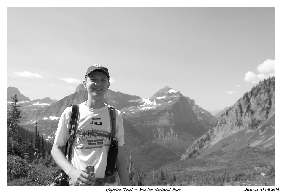
Day 8 - Sunday 7/31/2016 - Hike Highline Trail
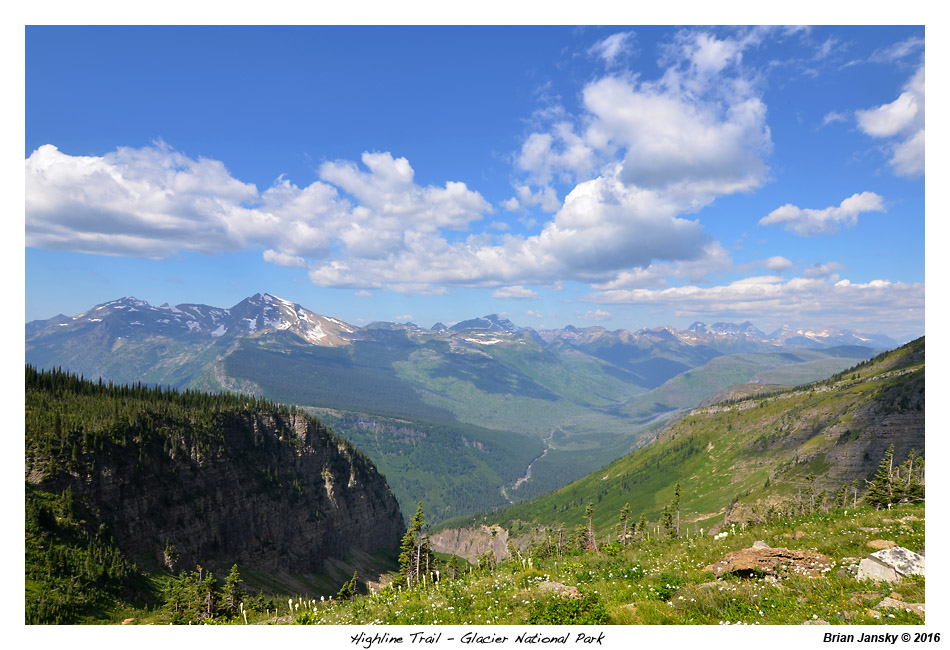
We were up by 6:00am and out the door by 6:30. Today, we were doing what is probably one of the best hikes in a park of fantastic hikes! The Highline Trail runs along the 'Garden Wall' from Logan Pass to Granite Park Chalet and then down to a bend in Going-to-the-Sun Road called The Loop. Most people recommend parking at The Loop and then taking the shuttle up to Logan Pass and then hiking the trial back down to it. Doing the hike from Logan Pass down to The Loop only having 975 feet of elevation gain, where as hiking from The Loop up to Logan Pass requiring 1920 feet of elevation gain.
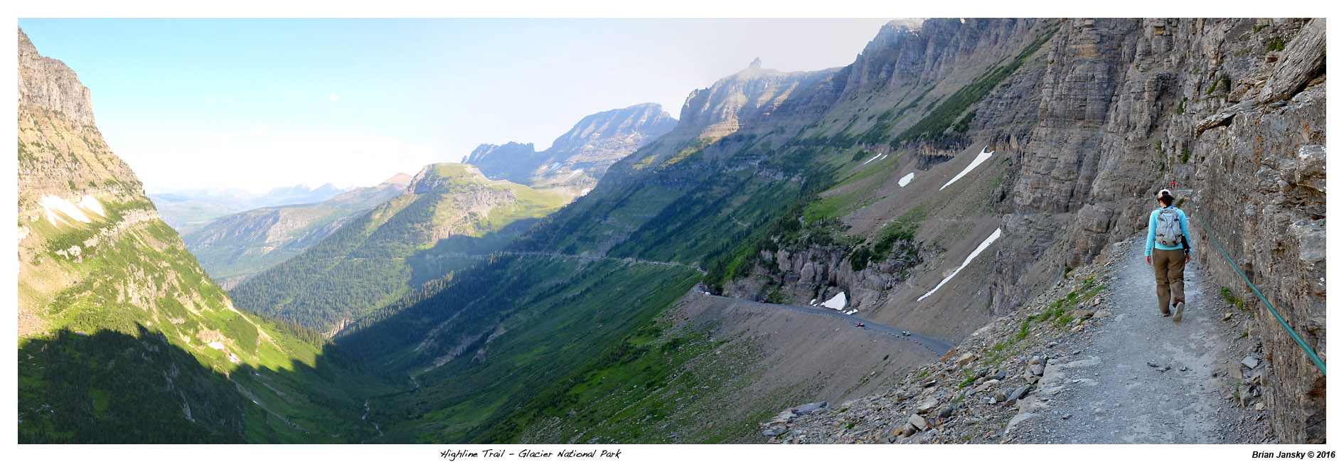
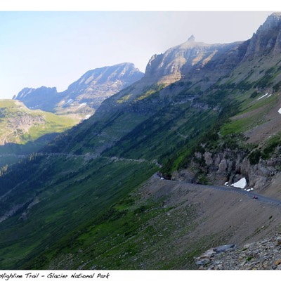
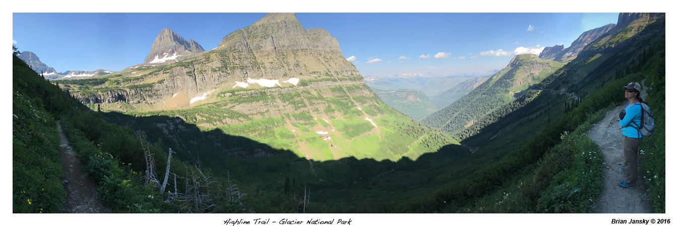
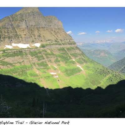
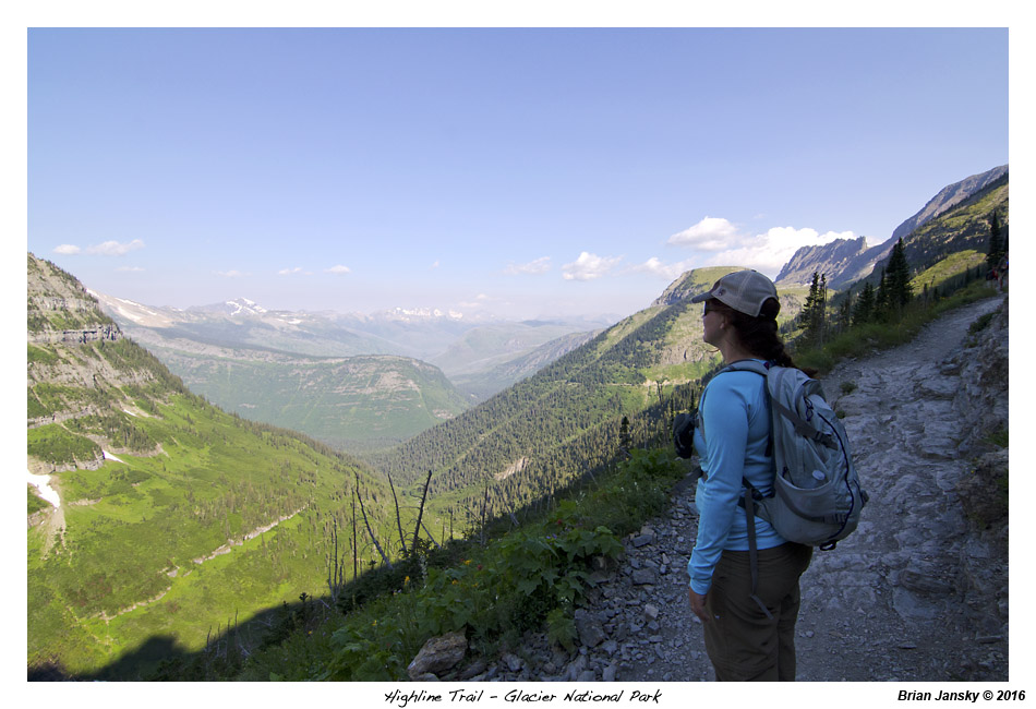
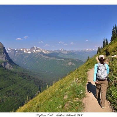
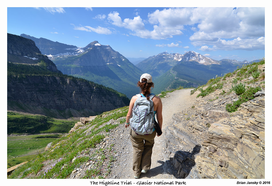
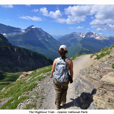
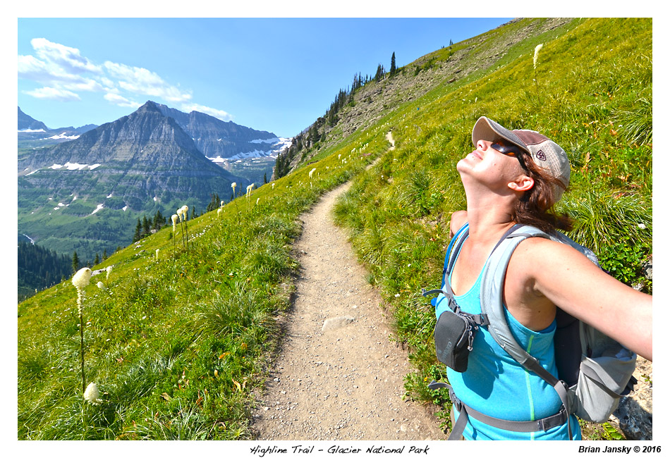
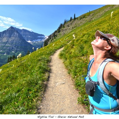
On the way out of Whitefish, we stopped at Super 1 Foods for another gallon of water to stock up. We arrived to The Loop parking area by a little after 8:00am. We were first in line for the shuttle up to Logan Pass which arrived about 8:30. At Logan Pass we hit the gift shop both picked up a long sleeve Glacier National Park shirt and started on the High Line Tail hike by 9:30. The hike starts mostly on the west side of the Garden Wall and therefore in the shade. The long selves shirts came in handy with the cool breeze on us. The Garden Wall is a tall, thin mountain wall that is the continental divide. The start of the hike was on a rock shelf with a cable to hold on to but we didn’t think it was nearly as narrow as some places of the Grinnell Glacier hike but being close to Logan Pass, it probably did see more foot traffic on it. You are pretty exposed being over 100 feet above Going-to-the-Sun Road.
We ran into a couple, Collin and Dana, who hiked with us all the way to Granite Park Chalet. Collin was the superintendent of Cameron ISD for about 5 years, 5 years ago. Cameron, Tx was a small town near the small town I grew up in. Small world! They were on week 5 of a travel trailer trip throughout the western US.
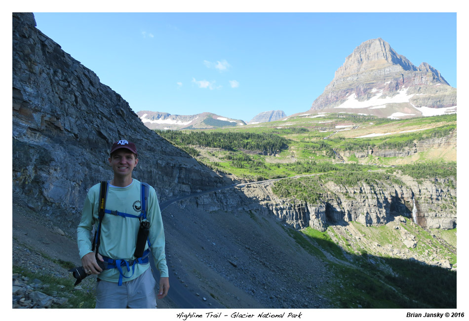
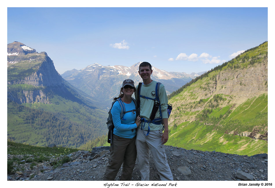
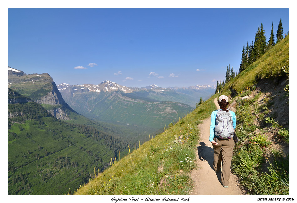
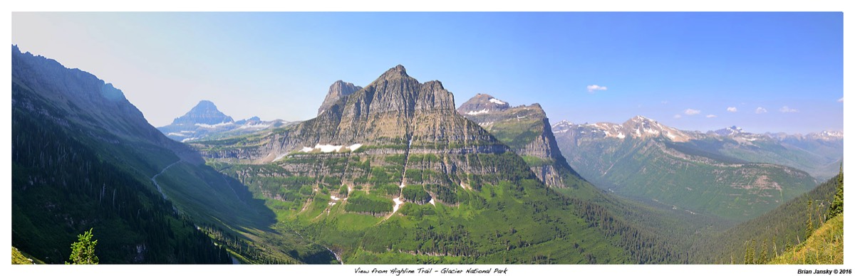
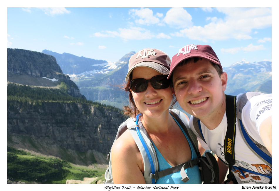
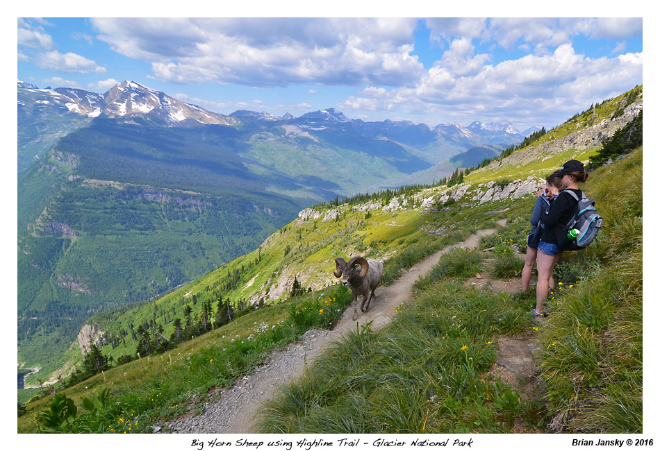
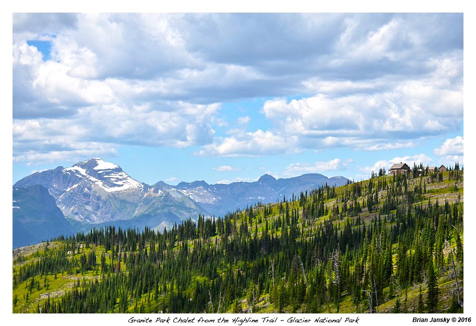
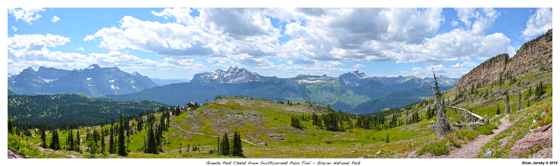
The trail proved to be spectacular! We ran into a big horn sheep that wanted to walk right down the middle of the trail toward us. The trail was pretty much on the edge of the valley so we scurried up the side a bit just to have him stop and eat right in front of us. He then continued on leisurely down the trail. He was a little closer to us than we liked but we made it out alright. About 3 miles into the hike the trail climbed up the only big obstacle on the hike, Haystack Pass. About a mile before we arrived at Granite Park Chalet, we arrived at the Garden Wall Trail. It is a side trail that climbs the Garden Wall for a great view from the top of Grinnell and Salamander Glacier (yes, they were just over the other side of the Garden Wall from us). We decided not to do the trail as it was about 900 feet of climbing in its one mile length so we continued on to Granite Park Chalet.
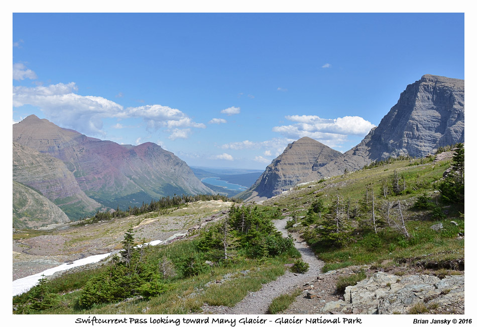
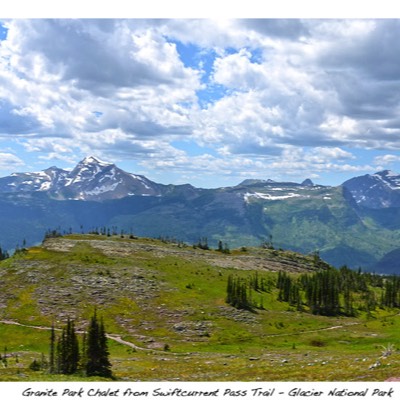
We made it to Granite Park Chalet by about 1:15pm. We rested a bit and bought a small bag of Cheetos. Emily and I then headed up Swiftcurrent Pass for a small 2 mile round trip side hike to look back into the Many Glacier area and sit on top of the continental divide. This added around 500 feet of elevation to our day.
We started the 4 mile 2200 foot decent from Granite Park Chalet to the Loop and our car about 2:30. It was steep downhill the entire 4 miles and it was almost as painful as if it was 4 miles up hill! It killed our toes! The hike took us through the area of the 2003 Trapper Creek Fire so there wasn't much in the way of shade.
On the way out of Whitefish, we stopped at Super 1 Foods for another gallon of water to stock up. We arrived to The Loop parking area by a little after 8:00am. We were first in line for the shuttle up to Logan Pass which arrived about 8:30. At Logan Pass we hit the gift shop both picked up a long sleeve Glacier National Park shirt and started on the High Line Tail hike by 9:30. The hike starts mostly on the west side of the Garden Wall and therefore in the shade. The long selves shirts came in handy with the cool breeze on us. The Garden Wall is a tall, thin mountain wall that is the continental divide. The start of the hike was on a rock shelf with a cable to hold on to but we didn’t think it was nearly as narrow as some places of the Grinnell Glacier hike but being close to Logan Pass, it probably did see more foot traffic on it. You are pretty exposed being over 100 feet above Going-to-the-Sun Road.
We ran into a couple, Collin and Dana, who hiked with us all the way to Granite Park Chalet. Collin was the superintendent of Cameron ISD for about 5 years, 5 years ago. Cameron, Tx was a small town near the small town I grew up in. Small world! They were on week 5 of a travel trailer trip throughout the western US.
The trail proved to be spectacular! We ran into a big horn sheep that wanted to walk right down the middle of the trail toward us. The trail was pretty much on the edge of the valley so we scurried up the side a bit just to have him stop and eat right in front of us. He then continued on leisurely down the trail. He was a little closer to us than we liked but we made it out alright. About 3 miles into the hike the trail climbed up the only big obstacle on the hike, Haystack Pass. About a mile before we arrived at Granite Park Chalet, we arrived at the Garden Wall Trail. It is a side trail that climbs the Garden Wall for a great view from the top of Grinnell and Salamander Glacier (yes, they were just over the other side of the Garden Wall from us). We decided not to do the trail as it was about 900 feet of climbing in its one mile length so we continued on to Granite Park Chalet.
We made it to Granite Park Chalet by about 1:15pm. We rested a bit and bought a small bag of Cheetos. Emily and I then headed up Swiftcurrent Pass for a small 2 mile round trip side hike to look back into the Many Glacier area and sit on top of the continental divide. This added around 500 feet of elevation to our day.
We started the 4 mile 2200 foot decent from Granite Park Chalet to the Loop and our car about 2:30. It was steep downhill the entire 4 miles and it was almost as painful as if it was 4 miles up hill! It killed our toes! The hike took us through the area of the 2003 Trapper Creek Fire so there wasn't much in the way of shade.


We got to the car about 4:15 and was back at the hotel by 5:30. We had reservations at a place recommended by the staff at the hotel called Tupelos at 8:00pm but we figured they could take us early. So we showered and headed over. They were full so we had drinks and an appetizer in their bar / lounge while we waited. Emily said the food was more creole instead of Cajun and we both thought the lounge / bar was better than the actual restaurant but it was a nice last night in Montana. We again had desert at Sweet Peaks ice cream and fell asleep watching Harry Potter.
Highline Trail - 11.8 Miles one way; 975 ft elevation gain with side hike up to Swiftcurrent Pass - 2 miles; 500 ft elevation
Total - 13.8 Miles; 1475 ft elevation gain
Safe Travels,
B&E
Highline Trail - 11.8 Miles one way; 975 ft elevation gain with side hike up to Swiftcurrent Pass - 2 miles; 500 ft elevation
Total - 13.8 Miles; 1475 ft elevation gain
Safe Travels,
B&E